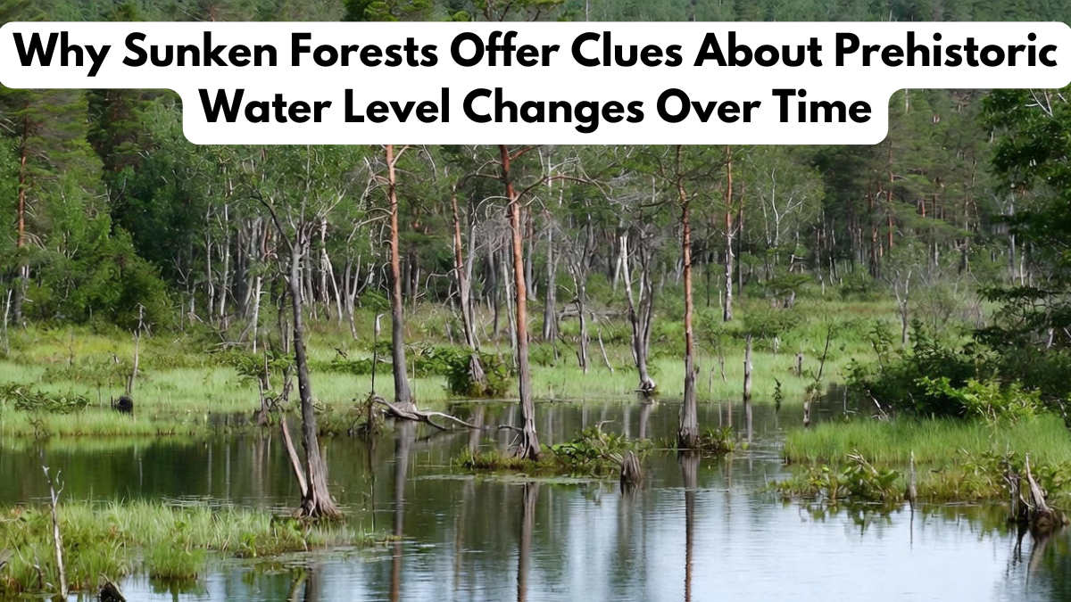
Beneath lakes, seas, and coastal waters around the world lie ancient tree stumps, preserved in remarkable condition for thousands of years. These submerged woodlands, known as sunken forests, are powerful markers of Earth’s environmental past. As scientists study these underwater landscapes, they uncover evidence about shifting coastlines, flooding events, and climate variations. Because tree stumps remain anchored exactly where they grew, they provide reliable indicators of how prehistoric water levels have changed over millennia. Each discovery contributes valuable information about ancient ecosystems, helping researchers understand long-term environmental transformations that shaped human and natural history.
How Sunken Forests Form and Why They Matter
Sunken forests typically form when natural events—such as rising sea levels, glacial melt, river shifts, or tectonic activity—cause once-thriving woodlands to become submerged. Over time, mineral-rich waters preserve the trees, maintaining their structure and allowing scientists to analyze them even thousands of years later.
These submerged forests are essential for studying prehistoric water levels because they reveal how land and water boundaries evolved. The depth at which the trees rest helps determine when and why flooding occurred. Their preserved rings also contain climate information, turning each tree into a biological record of its era.
What Sunken Forests Reveal About Ancient Climate Conditions
The exceptional preservation of sunken forests makes them valuable tools for paleoenvironmental research. Scientists analyze tree rings, root systems, and the surrounding sediments to reconstruct ancient climate conditions. Because trees respond directly to environmental changes—such as drought, flooding, or temperature fluctuations—their rings reveal seasonal patterns and long-term climate cycles.
When paired with sediment analysis and carbon dating, these trees help researchers pinpoint shifts in prehistoric water levels. For example, discovering a forest submerged twelve meters below the current sea line suggests dramatic flooding or sea-level rise occurred after the trees died. Comparing sunken forests across regions allows scientists to map global climate patterns and understand how ancient environments influenced early human settlement.
Key Scientific Methods Used to Study Sunken Forests
Several advanced techniques help scientists extract meaningful data from submerged trees. The table below highlights common research methods used to study sunken forests and their contributions to understanding prehistoric water levels:
| Research Method | Description | Contribution to Prehistoric Water Level Studies |
|---|---|---|
| Dendrochronology | Study of tree rings | Reveals climate patterns, growth conditions, and environmental stress |
| Carbon Dating | Measures age of preserved wood | Determines the timeline of submersion events |
| Sediment Analysis | Examines soil and mineral deposits | Identifies flooding causes and environmental context |
| Underwater Mapping | Sonar and 3D imaging of submerged forests | Helps measure depth changes and geological shifts |
| Geological Surveys | Studies surrounding rock formations | Provides clues about tectonic movements and erosion |
These combined techniques allow for accurate reconstructions of ancient landscapes and water level changes.
How Sunken Forests Help Scientists Understand Human History
Understanding prehistoric water levels is essential for interpreting ancient human migration, settlement patterns, and survival strategies. Many early civilizations developed near coastlines, rivers, and lakes—areas highly susceptible to environmental shifts. When water levels rose or fell dramatically, people were forced to relocate or adapt.
Evidence from sunken forests helps archaeologists determine when certain regions became inhospitable or submerged. By connecting forest data with archaeological findings, scientists can identify when humans abandoned settlements, changed hunting strategies, or moved inland. These submerged woodlands serve as environmental timelines that mirror human adaptation and resilience.
Modern Climate Change Insights from Ancient Forests
Although sunken forests formed thousands of years ago, they offer valuable lessons for today’s climate challenges. Many prehistoric flooding events were triggered by rapid glacial melting or sudden temperature shifts—conditions similar to modern climate change. Studying how landscapes responded then can help predict future changes in coastlines and water systems.
The trees’ responses to environmental stress also help scientists understand how ecosystems may react to ongoing warming. By comparing ancient data with modern measurements, researchers gain insights into long-term climate cycles, giving us a clearer picture of future impacts on agriculture, wildlife, and coastal cities. This connection underscores how studying prehistoric water levels contributes to planning and adaptation strategies today.
Conclusion
Sunken forests are extraordinary natural archives that reveal how Earth’s water systems and climates have transformed over thousands of years. These submerged landscapes provide scientists with clear evidence of prehistoric water levels, offering insights into past flooding events, sea-level rise, and geological changes. Their preserved tree rings and surrounding sediments help reconstruct ancient environments, deepening our understanding of climate history and human adaptation. As modern climate challenges intensify, the lessons hidden within sunken forests become increasingly important. By studying these underwater time capsules, researchers can better prepare for the environmental changes that lie ahead.
FAQs
How do sunken forests form?
They form when rising water or geological shifts submerge existing forests, preserving them underwater.
Why are sunken forests important to scientists?
Sunken forests reveal how landscapes and climates changed, helping researchers track prehistoric water levels.
What tools are used to study sunken forests?
Scientists use dendrochronology, carbon dating, underwater mapping, and sediment analysis.
Can sunken forests show evidence of ancient floods?
Yes, their depth and preservation often indicate major flooding or sea-level rise events.
How do these forests help predict future climate change?
By showing how ecosystems responded to past environmental shifts, sunken forests provide clues for modern climate planning.
Click here to learn more